Where is this little figure?
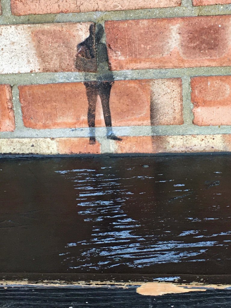
Yesterday’s Photograph
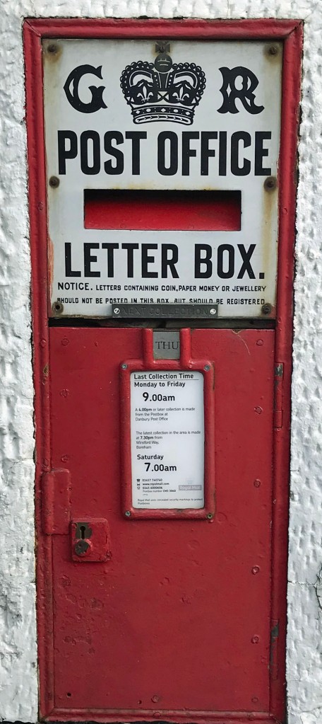
The ‘GR’ post box is in the wall of the old Post Office next the Griffin Inn.
Where is this little figure?
Yesterday’s Photograph
The ‘GR’ post box is in the wall of the old Post Office next the Griffin Inn.
Where is this letter box? It seems to be the last remaining ‘GR’ letter box in Danbury, all others now being ‘ER’.
Yesterday’s Photograph
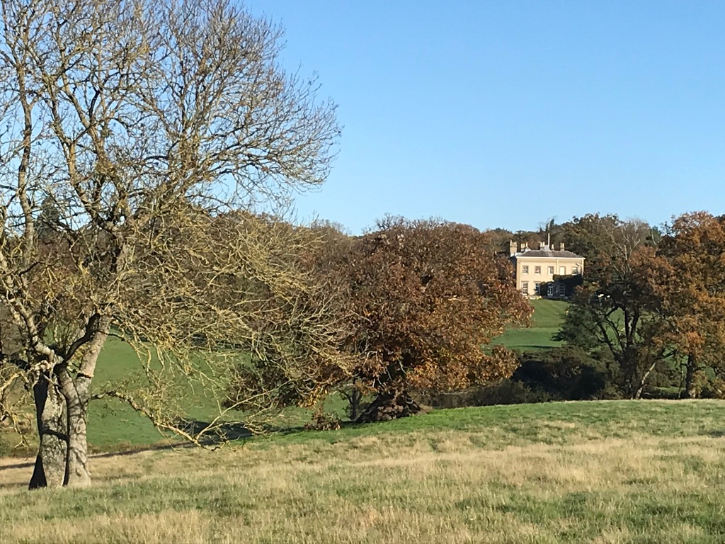
The building in the background is Riffhams. It is just inside the Danbury parish boundary, whereas Old Riffhams, the original manor house, is in Little Baddow. The ‘new’ Riffhams was built around 1815 by John Robert Spencer who had inherited the estates. The map below shows where the photograph was taken.

Image credit: © OpenStreetMap contributors. Base map and data from OpenStreetMap and OpenStreetMap Foundation. Data is available under the Open Database Licence, cartography is licensed as CC BY-SA as per the OpenStreetMap copyright page.
This is a beautiful pastoral view taken from a public footpath. What is the building on the other side of the meadow?
Yesterday’s Photograph
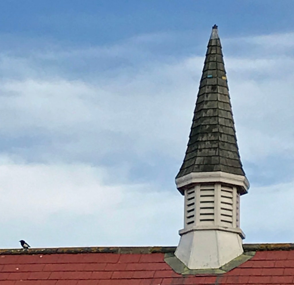
The spire sits on top of Danbury Village Hall.
There is an interesting history of the Village Hall on the Danbury Society’s Blog Spot, written at the time of the hall’s 100th Anniversary. Apparently, the hall was built in 1911 and officially opened in April 1912 with the first recorded letting in June 1912 when performers paid 15s-0d to hire the hall.
Another easy one for you. Which building boasts this spire?
Yesterday’s Photograph
The moulded brickwork plaque is on the side of Frettons and can be seen from Church Green.
An interesting History of Frettons can be found online at ‘Garglyark’. Apparently the core of the building dates from the 15th Century and there have subsequently been a number of modifications and extensions, so presumably the date shown here relates just to this part of the house.
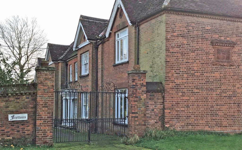
Where is this plaque of moulded brickwork?

Yesterday’s Photograph
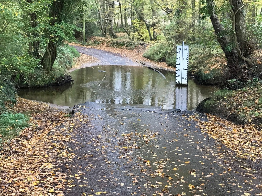
Was of the ford in Sporhams Lane.
This is the only ford within the Danbury parish boundary. Where is it?
Yesterday’s Photograph
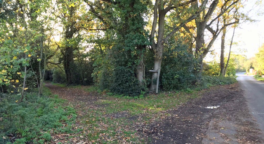
was of the north end of the footpath known as Pedlars Path at its start point in Cherry Garden Lane. It runs through to Danbury Vale. Originally it continued through to Capons Lane but the southern end of the footpath is now a road, and this retains the name of ‘Pedlars Path’. See map below.
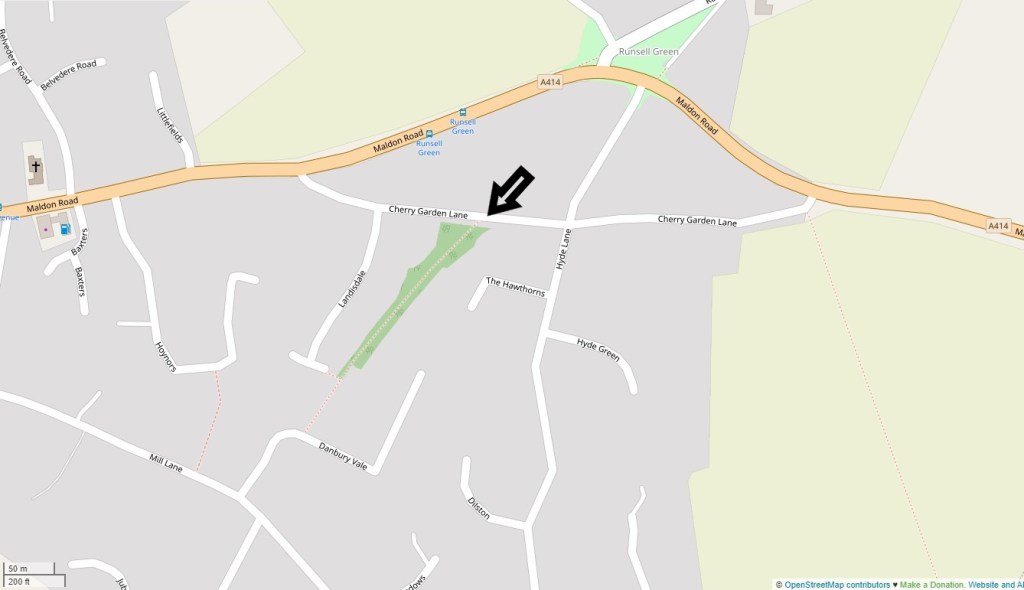
Image credit: © OpenStreetMap contributors. Base map and data from OpenStreetMap and OpenStreetMap Foundation. Data is available under the Open Database Licence, cartography is licensed as CC BY-SA as per the OpenStreetMap copyright page.
Where is this footpath/bridleway, what is it called and where does it lead?
Clue: It starts on the east side of the village and goes in a southerly direction.
Yesterdays Photograph
is of the Ice House in Danbury Park.
Ice houses were used for the storage of food and to cool drinks. During the winter ice would be cut from local sources, such as the nearby lakes, and packed with straw or sawdust for insulation. Often the ice would remain frozen through to the following autumn.
In the 19th century considerable amounts of ice were imported from Scandinavia to support commercial ice houses but this declined in the early 20th century when factories started to make ice artificially.
Where is this and what was its original use?

Yesterday’s Answer
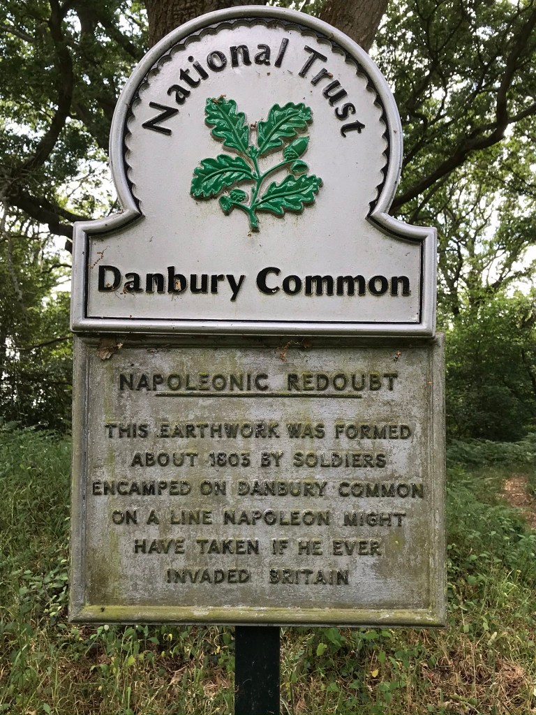
The Napoleonic Redoubt is on Woodhill Road close to the junction with Well Lane. ‘Redoubt’ is defined as ‘a fieldwork enclosed on all sides’ and there would have been others created at that time, traces of which have not survived.
The Redoubt at Harwich, also built during the Napoleonic wars, is quite different and more like a fort.
There were strong fears of an invasion in the early 1800’s which resulted in a line of defences being built from East Sussex to Suffolk. These included some 29 Martello Towers built between Felixstowe and Jaywick, and a further 27 between Folkstone and Dymchurch. Additionally the Royal Military Canal, some 28 miles long, was built from Hythe almost to Hastings. These were supported by the major military fortification of Dover Western Heights and Chatham Dockyards.
Although Napoleon’s final defeat came at Waterloo (Belgium) in 1815, the major losses he incurred against Russia in 1812 greatly reduced the possibility of an invasion, so work on the East/South coast defences ceased at this point.
This sign is self explanatory, but where is Danbury’s Napoleonic Redoubt?
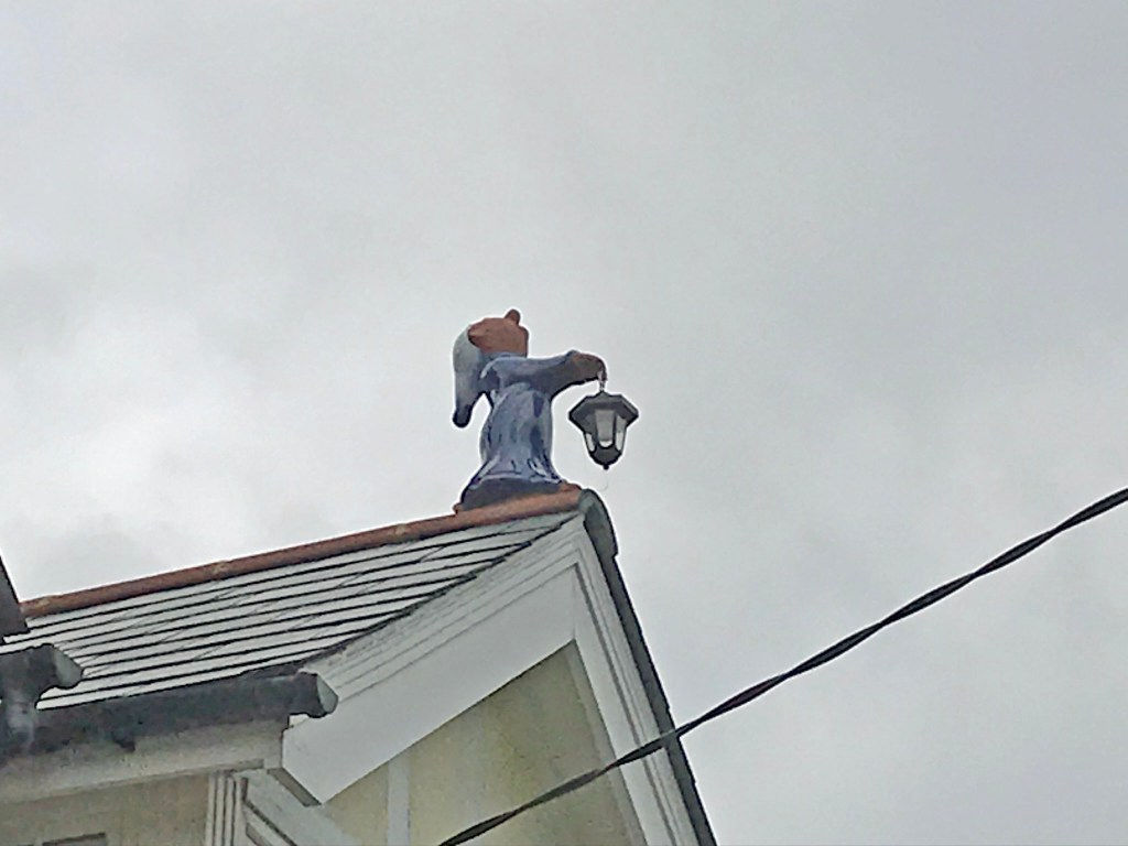
Yesterday’s Photograph
The candle carrying character is on the roof of No. 67 Main Road, just up the hill from the Yacht Equipment shop.
Which house has this ‘Sleepy’ character on its roof.
Yesterday’s Photograph
is of Quinlan Court, seen from Mill Lane. Quinlan Court sits behind the Danbury Medical Centre.

You must be logged in to post a comment.