Wonderful Christmas decorations made from corks
Wonderful Christmas decorations made from corks


Where is this Church?

Yesterday’s Photograph
This carved tree is at the entrance to Danbury Country Park, in Well Lane opposite Beaumont Park.
Where is this ornately carved tree (The pumpkin was only there for Halloween!)

Yesterday’s Photographs
Were taken in Gay Bowers Lane.
The trees in this lane give a very dramatic effect. Where is it?
(probably looking a bit different now the leaves have fallen.)

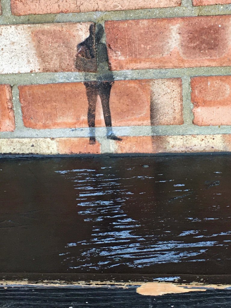
Yesterday’s Photograph
The little figure is above the seat in the bus shelter on the opposite side of the road from the Co-op store.
Take a careful look at the next photograph.

Where is this little figure?
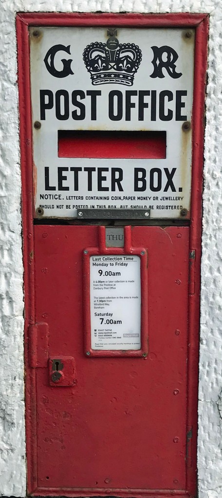
Yesterday’s Photograph
The ‘GR’ post box is in the wall of the old Post Office next the Griffin Inn.
Where is this letter box? It seems to be the last remaining ‘GR’ letter box in Danbury, all others now being ‘ER’.
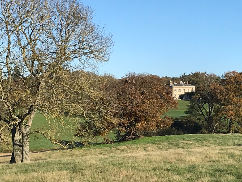
Yesterday’s Photograph
The building in the background is Riffhams. It is just inside the Danbury parish boundary, whereas Old Riffhams, the original manor house, is in Little Baddow. The ‘new’ Riffhams was built around 1815 by John Robert Spencer who had inherited the estates. The map below shows where the photograph was taken.

Image credit: © OpenStreetMap contributors. Base map and data from OpenStreetMap and OpenStreetMap Foundation. Data is available under the Open Database Licence, cartography is licensed as CC BY-SA as per the OpenStreetMap copyright page.
This is a beautiful pastoral view taken from a public footpath. What is the building on the other side of the meadow?
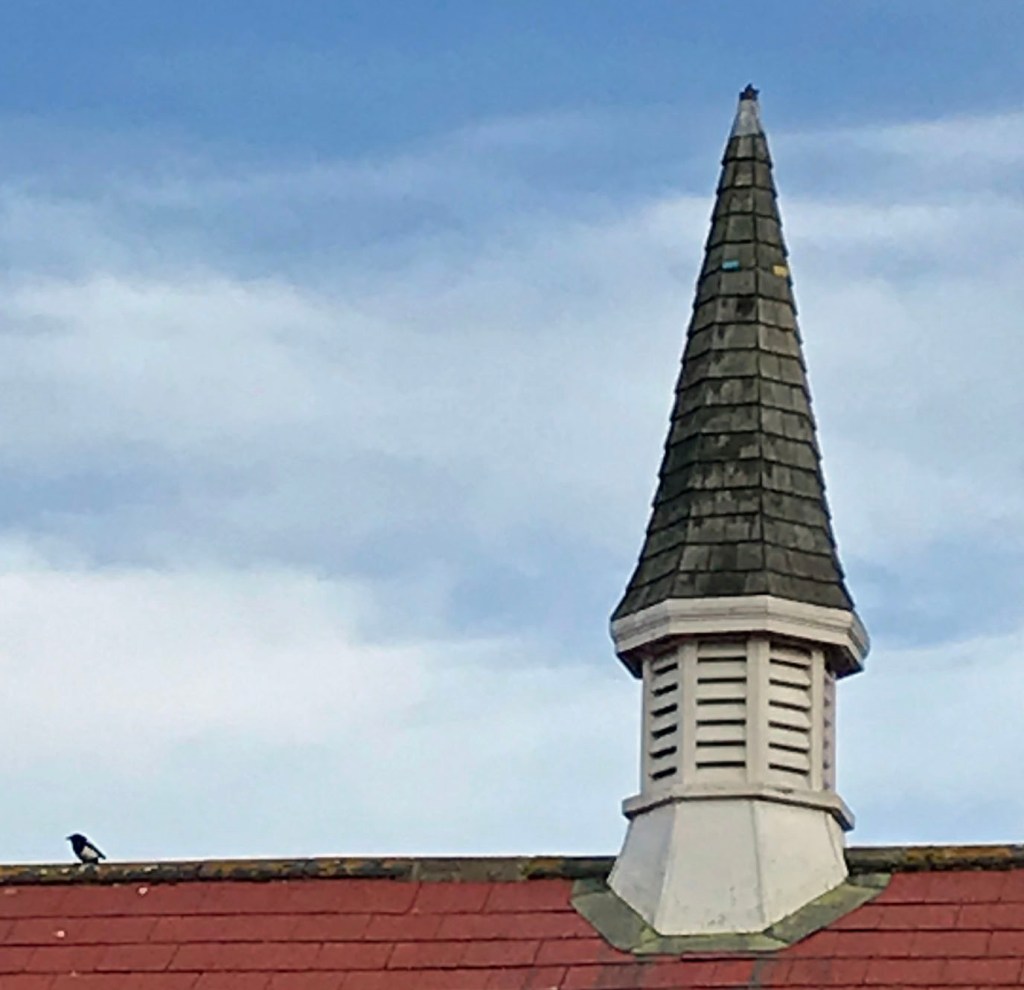
Yesterday’s Photograph
The spire sits on top of Danbury Village Hall.
There is an interesting history of the Village Hall on the Danbury Society’s Blog Spot, written at the time of the hall’s 100th Anniversary. Apparently, the hall was built in 1911 and officially opened in April 1912 with the first recorded letting in June 1912 when performers paid 15s-0d to hire the hall.
Another easy one for you. Which building boasts this spire?
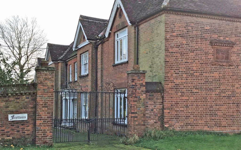
Yesterday’s Photograph
The moulded brickwork plaque is on the side of Frettons and can be seen from Church Green.
An interesting History of Frettons can be found online at ‘Garglyark’. Apparently the core of the building dates from the 15th Century and there have subsequently been a number of modifications and extensions, so presumably the date shown here relates just to this part of the house.

You must be logged in to post a comment.